1 Native Lands
All lands and seas in North America were once stewarded by Indigenous peoples before the arrival of colonists from Europe. Claims held over these lands did not stay constant and changed frequently over time as people moved. Borders were often dynamic and porous, contrasting with the prevailing settler practice of drawing and enforcing static boundaries. There are many resources that provide an overview of Native nations and cultures and the legacy of oppression that led to the removal of many from their ancestral lands. The following resources provide an introduction to whose lands are occupied by settler governments with a focus on the United States and Canada.
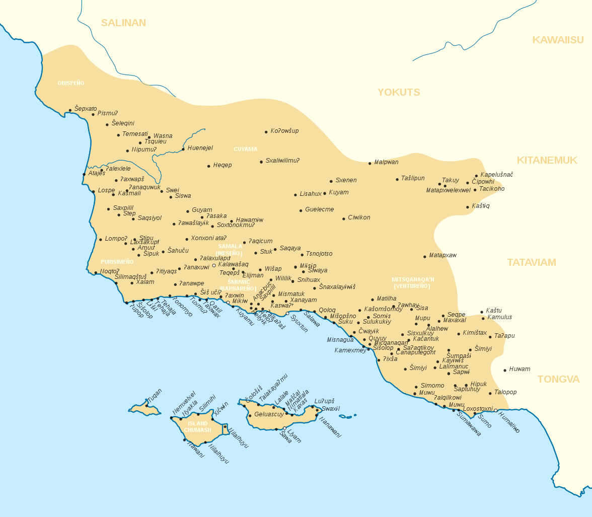
Figure 0.1: Chumash villages and surrounding Native lands (Source: Wikipedia Commons)
Native Land Digital. 2023.
This global map – produced by a Canadian non-profit led by First Nations people – provides an overlapping view of Indigenous territory throughout the world. This is more inclusive of different subgroups compared with other resources and provides a way to view ancestral territory throughout the Pacific Coast region.
U.S. Domestic Sovereign Nations: Land Areas of Federally-Recognized Tribes
Bureau of Indian Affairs. 2023.
This resource is maintained by the Bureau of Indian Affairs under the U.S. Department of the Interior. According to the Bureau, it shows “the external extent of Federal Indian reservations, land held in ‘trust’ by the United States, ‘restricted fee’ or ‘mixed ownership’ tracts for Federally-recognized tribes and individual Indians.” This is not a complete listing of Native lands in the United States. Rather, it shows the current extent of what the federal government recognizes as Native Land.
California Native American Ancestral Lands
Los Padres Forest Watch. 2021.
This interactive map, built by a non-Indigenous organization in ArcGIS, provides an incomplete, high-level overview of traditional Native territory throughout California. It does not include all of the Native nations and cultures in the State, but provides a helpful interactive tool to explore the overlay of traditional territory with current land use patterns including state and federally designated protected lands.
California Native American Heritage Commission. 2023.
This is a state-produced resource with additional information on population distribution, historical events, trade routes, missions, and other data pertaining to Native history in California. The Commission also hosts a written summary of this history and database of Native groups available on the main website.
California Tribal Lands and Reservations
U.S. Environmental Protection Agency. 2023.
This resource provides a California-specific version of the above resource from the Bureau of Indian Affairs. The extent of government-recognized Native lands is considerably smaller than the lands once stewarded by Indigenous people in what is now known as California.